Export Properties of a SpatialZone
Feature Group: Export, Store | PostgreSQL
Collecting all the properties that apply to all elements of a spatial zone requires significant processing.
Therefore we have here a full export for all relevant elements and their properties in a bundle. It is both made available as a .csv file and loaded in the bundleUnitProperties table.
Base on this, it is then possible to export subsets on demand at a lower processing cost.
Populate bundleUnitProperties
Submit the processing request
#
#  Populate bundeUnitProperties with the properties of the spatial units
#
class PopulateBundleUnitProperties_Instruction(BaseModel):
    bundleId: str | None = "1"
    ifNotPopulated: bool | None = True # When True, the processing  will be skipped if the bundleUnitProperties is already populated
    withCSVExport: bool | None = True

class PopulateBundleUnitProperties_Result(BaseModel):
    skipped: bool | None = False # True if the bundleUnitProperties was already populated and ifNotPopulated was set to True
    nbrEntries: int | None = 0 # Number of entries created in the bundleUnitProperties
    resultPath: str | None = '' # relative path of the result file (csv)
    runtime: float | None = 0.0 # in seconds
Result
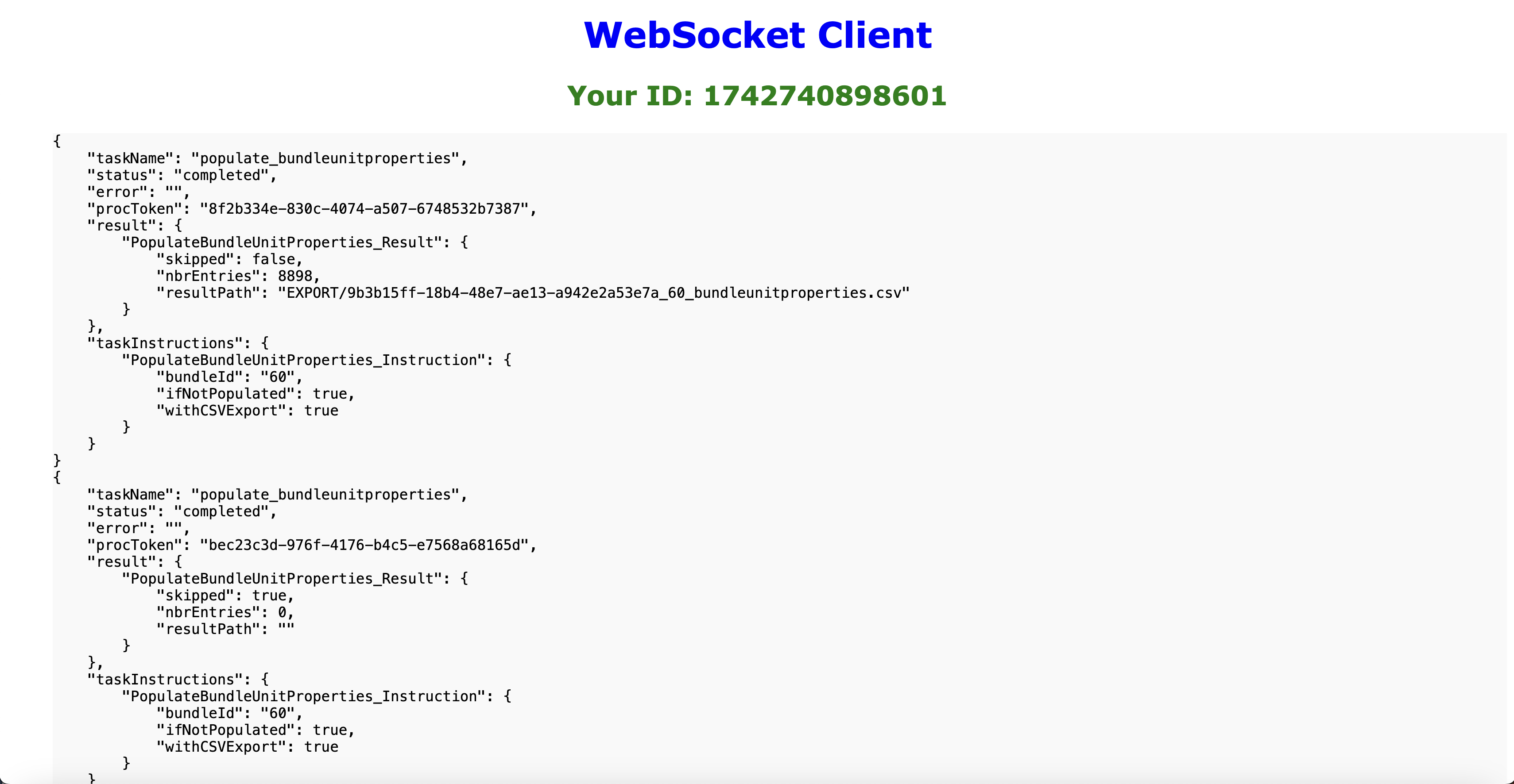
The following screen capture shows two subsequent executions of the request: at first there are no data for the bundleId = 60, thereafter the processing is skipped